Thursday, July 7, 2011

Ochocos and beyond- more pictures from the ride

The last post I left off with some pictures of my camp from the third night out. Day four started out with more climbing.  If there is one thing I feel like I do fairly well on a bike, it is climb hills.  Not racer fast by any means, but for a tourist and recreational rider I hold my own when the road turns skyward. Some people collect stamps, others coins, spoons, plates, crystal doorknobs, shot glasses, whatever.  I started collecting summit signs. Now, the various state departments of transportation would get a bit miffed were I to actually take home the signs, so pictures have to do.  I'm sure I missed one on the Santiam pass, but here is the first one collected on this trip:


On the small side, but still a keeper.

From here it was an easy cruise down in to Mitchell.  Not much traffic, nice, but not spectacular scenery, and enough wildlife sightings to keep it interesting, but no truly unusual or noteworthy creatures.  One deer decided to cross the road in a manner that made me really glad for the very effective brakes my bike is equipped with, but basically uneventful. 

Since the point of this  trip is to see the area I am passing through, I took the business route through Mitchell.  Outside the first cafe I came across a couple of fresh out of high school guys I had met in Sisters who were riding to Missoula, Montana, along with Diana, who had just finished the veterinary medicine program at Oregon State and was headed to Georgia on her bike.  They were saying their farewells to yet another rider who had covered most of the contiguous states, and figured there was one more American continent still to explore.  He was headed west to the coast, then south, the rest of us east, so I went from a solo rider to one of a group of four.  A few hours later it started feeling like lunchtime, and when we found a shady wide spot along the road, it was occupied with this group:
Turned out to be Laurie, whom I had met on the climb up the Santiam pass two days prior, and the rest of her group.  Their plan was to overnight in Dayville, which seemed reasonable to the rest of us, so one who had become four was now ten.  Riding on tour with a group of ten is not at all like racing in peloton.  The only jockeying for position was just getting close enough when someone was telling a story you wanted to hear.

We continued on over another, even smaller pass,
past the Wheeler historical marker,
and continued on to Dayville.  If you have been to Dayville you are probably trying to determine what the appeal was.  There is not much more than a post office, two mini marts, a cafe that never seems to be open, and a few dozen homes.  It seems that at some point the good Presbyterian folks in Dayville realized that their town sat on a major cycling route, and that touring cyclists sometimes like to sleep indoors, maybe take a shower or wash some grimy bike shorts.  If I may continue to make some assumptions, I will guess that these good folks had read the parts in their Bibles that talk about doing unto others, and loving your neighbor, and decided to do something about it.  The doors of Dayville Presbyterian are never locked, and the sign inside welcomes cyclists to sleep, cook, shower and do laundry, just please refrain from smoking, drinking, or sleeping on the pew cushions.  If you can leave a donation, great.  If not, that is okay too.  Judging from the number of new looking appliances with the label "purchased with biker donations", I would guess that most are able to leave at least a few dollars.  Someone sent this to the church:

Notice the lower right corner.

We stayed, we washed and cooked and slept and donated, then the next morning went on our way, knowing that our group would shrink soon, as I turned south at John Day and the rest of them continued east.

Tuesday, July 5, 2011

Back Home- time for some pictures

I'm home again, the trip is done, real life is taking over again.  At least I have access to a proper computer and Internet connection, so now I can post some of the pictures.  I'll try not to put up too many in any one post, so those with a slower connection need not suffer too much.  Pictures not big enough for you? Just click on them, they grow.

Lets go back to the beginning.  The first couple of days were devoted to getting out of the Willamette Valley, so pictures are a little sparse, but I have a few.

From the very beginning, here is the beast, fully loaded:

.

And, just his bike:

I don't know the total weight, it was a conscious decision not to weigh it, I was sure I would be happier not knowing.  I saw a lot of rigs on the road that looked to be loaded up a lot heavier.

I was pretty focused on just getting miles on the first day, heading across highway 224 from Estacada to Detroit, but I am a sucker for a good wildflower shot:
Too bad the yellow is Scotch Broom, an invasive species that is spreading rapidly around here.  Still pretty to look at, as long as you don't think too much about it.

If you have been following this from the beginning of the trip, you may remember that day two, crossing the Santiam pass in to Sisters, was not the best day of the trip.  With better weather there are some great views on that route, but the rain was heavy enough that day that you couldn't see much, and I just wanted to get through the day.  By day three though, the skies had cleared, I was headed east, and the landscape was starting to remind me what this trip was about.  I like the high, sagebrush and juniper desert and a road that keeps rolling into the horizon.

I kept rolling, past Prineville and along the Ochoco Reservoir.  I think I mentioned my surprise at spotting these guys:


Yep, pelicans.  Lots of pelicans, a bird I had not realized inhabited Oregon, especially not this far inland.

After a couple of fairly hard ride days, I was ready to make day three a little easier, which meant camping in the Mitchell city park wasn't going to happen.  Time to head towards the national forest and find a nice spot off the road for my night's rest.

This looked like it held promise:


Just past the gravel pull out was a pile of rocks and logs blocking automotive access to a decommissioned forest road along a stream.  I followed it a couple of hundred yards past this:


and made camp here:


among these:


I told you I was a sucker for wildflower pictures.

That wraps up the first three days, and day four brought new and different adventures, I will pause here for now, and continue the journey in the next post.

Tuesday, June 28, 2011

Burns, again.

Since the last post, I made a two day trip to get to Frenchglen, via Crystal Crane Hot Springs and the Pete French round barn.

The hot springs were pretty developed, campground and cabins and such, but it was a place to pitch the tent with both the springs to soak in, and a shower.  I've actually done much better for finding showers than I expected, but they are always welcome.

Heading south from Burns the one big tell-tale that I was nearing the landscape I was seeking was the smell.  At one point, it was like hitting a wall of sagebrush aroma.  I was also getting in to the marshlands, with more birds than I could count or identify.  They have "enjoyed" the same wet spring here that we have on the western side of the state so things are greener and wetter than I have ever seen them over here.

The round barn is quite a sight.  The only remaining one of three such structures French had built on the land he controlled, it is 100' in diameter, with a 60' diameter inner structure of stables and living quarters, allowing a 20' wide exercise track within the barn to keep the horses in condition over the winter.  The roof is built like an umbrella, with a massive central post and rafters radiating out to the circumference of the barn.  Remember, this is high desert country, so all the timber had to be hauled in for the barn, before the time of log trucks and Lowe's home delivery.

My only disappointment with the barn was that the time I finally get to see it, the water level from the nearby lake had risen to the point that the barn was knee deep is rather unappealing mosquito breeding ground.

From there I took the northern portion of the diamond loop road, through the diamond craters.  Visually very impressive, it was definitely not something I would want to hike through.  Massive, buckled lava ridges broken up by deep fissures and the scattered crater.  I walked just far enough off the road to get some pictures of some of the more impressive features, but between the random cracks and holes, I was leery of stepping into some hidden opening and either breaking a leg or finding something dwelling in said hole that would take offense to my intrusion.

By this time I was hoping to see antelope and mustangs in addition to all the birds.  Instead, I was surprised to watch a mink dart across the road in front of the bike, carrying what looked like a salamander in his mouth.  Antelope sitings were not to come until much later, and I still haven't found the mustangs.

Friday afternoon brought me to Frenchglen, a full week ahead of when I needed to arrive.  John Ross, the state parks concessionaire who has operated the hotel for 20 years is a great host.  He does not allow camping on the hotel grounds to anyone arriving by car or motorcycle, but allows bicyclists to stay free.  Use of the hotel shower or his laundry facilities is a $5.00 charge, not bad considering most campgrounds charge $15 for a tent site.

Supper at the hotel is by reservation only, one family-style seating and you get what John is serving that night.  I was lucky enough to get a spot at the table Friday for Prime Rib, salad, roasted potatoes, vegetables au gratin and home made rolls, with chocolate cake a la mode for desert.  I was a little embarrassed when I realized how full I had heaped my plate, but there was plenty of food, nobody got shorted, and there was enough that I didn't feel too bad about taking seconds.

The family style seating encourages one to get to know the other guests, and arriving in the middle of nowhere on a bicycle made me a bit of a novelty, so there was no shortage of dinner table conversation.  I was seated with a retired couple who volunteer with BLM doing archaeological surveys, and spend August as the caretakers/hosts at the Riddle Brother's Ranch, one of the historical sites nearby.  Fascinating folks to listen to, they had plenty of local knowledge and suggestions of sites I could ride to.

So, now time for some exploration.  More stories to come, and eventually I will find a modern enough computer to upload some pictures!

Thursday, June 23, 2011

The long and winding road....

Another library, another computer.  I didn't think there were any computers left without a USB port, but there are, and they are all in Burns.  I guess when I get home there will be a major picture fest, unless I have better luck later on.

My guess is this will be my last computer access, unless I can talk the hotel in Frenchglen in to letting me use one.

Since my last post in John Day I have seem some parted ways with the group I had fallen in with.  I had kind of gotten used to the company, but they did distract a bit from the journey.  I'm hoping for good roads for them as they continue east.

John Day and Canyon City have some interesting museums, Kam Wah Chung in John Day is an amazing peek into gold rush era Chinatowns, and the Grant county historical museum is a fascinating hodge-podge of antiques, mining and cattle equipment, tribute to leading citizens, and some truly hideous "sculpture" of local notables.

I had intended on another short day from John Day, intending to stop at Seneca, maybe Silvies, and not hit Burns until today sometime.  My stop at the Grant county museum set me on the road as the day was heating up, and I really should have taken a closer look at the topography of my route.  By the time I hit the roughly 5200' summit, I was getting a little concerned about my water supply.  I've used the filter already on this trip, but that only helps when there is something to filter from.  Summit to Seneca is nine miles, some downhill, mostly flat.  Seneca city park had the water turned off, so the next stop was the mini mart, virtually the only business in town.  At least the Gatorade was cold, and the hot food case burrito was fresh sometime this week.  Filled up the water bottles at the store, and since I wasn't getting any real welcoming vibes from the locals, I figured Silvies was the next spot on the map, about ten miles away.

Silvies is a sign, a defunct post office, and a ranch with lots of no trespassing signs on the fences.  You also start climbing again.  I was half way between John Day and Burns, really not in to a 70+ mile day with two major climbs, so I started watching for a campground.  I also watched a couple of nice sized buck deer bound along the road, parallelling me until they saw a truck coming, then they needed to cross the road.  The results of this were slightly better than anticipated, everyone lived, but I heard the ping of the second deer's hoof on the hood of the truck.  He missed a stride or two, got his feet back under him and kept going.  The driver stopped to check the damage, acknowledged that he and the deer both got lucky, and since we were the only two people for miles, I refrained from asking how he failed to see the deer in time to stop.  It is not like he had just come across a bend in the road, none of those for miles either way.  I did ask what was ahead for camping and water, and he assured me it was only a couple miles to Idlewild campground, and there was water there.

Eight or so miles later, still no campgrounds, and the gathering clouds I had been watching were starting to concern me a little.  A flash, an interval, then a boom, far enough off that I wasn't too concerned yet.  More flashes, more booms, shorter intervals, a few big fat drops of rain.  Okay, I'm ready to find that campground and get set up before it really hits.  Then, it really hit.  Hail instead of rain, and a headwind like I hope to never find again.  Stop, pull on the rain gear, turn on the lights so the other idiots on the road in this stuff might see the idiot on the bicycle.  Finally, the big brown sign announcing the campground, adorned with a blue sign stating simply "closed".

Too late to get set up dry even if I ignored the closed sign, and closed would mean the water was shut off, so I decided the 22 remaining miles to Burns was my best option.

Now, at 47 years old, I had been scared in a storm once, when I was living in Arkansas and the oak tree about twenty yards from the trailer I lived in was struck.  The count is now up to two.  When you simultaneously feel the reverberations of the thunder, and a pretty significant tingle, that is just way too close.  Fortunately, I had hit the final summit at about this time, so I was able to make a little better time downhill, at least once the rain and hail let up enough that I could see where I was going.  At this point, camping was no longer an option.  I was going to get to Burns and get a room.

Eventually, I hit Hwy 20, buy which time the storm had cleared, and the rain gear was now a very effective sauna.  I stripped off as much as I felt was appropriate, shifted into the highest gear I could still push, and cranked it on in to Burns, found the City Center Hotel, rooms starting at $36.99/night.  Score! The AC didn't work, most of the light bulbs were burned out, but it was the first real bed since I left home, and a shower that felt so good I took two.

Today is sunny and beautiful again, I've hit the laundromat, visit info center, and now the library to post this.  Harney county museum is next, then another short day south towards the Pete French round barn!

In spite of a couple of weather incidents, I am having a great time still.  If I get access to a computer, I will post again, if not I will update at home.  Gotta get some pictures up eventually!

Tuesday, June 21, 2011

Five days, finally a computer

Well, it took longer to get access to a computer that works than I expected.  This is day five of the trip, and I am in John Day, OR.

With four and a half days of travel behind me it is hard to know where to begin.  The fact that I am making this update should let you all know that I am still safe and sound.  I know there are some prayers being offered up on my behalf, and they seem to be working so far.  No mechanical issues, no close calls with traffic, almost idyllic all in all.

Almost idyllic. Day two, from Idanha (just outside of Detroit) to Sisters was a bit challenging.  Less than 55 miles, even with the climb over the Santiam pass this should not have been a major event, except I did not manage to stay ahead of the rain.  The forecast 30% chance of rain felt more like 30" of rain, and I'm not sure the temperatures at the top of the pass were much above the 30's either.  I was about a half hour in to the days ride when the rains started.  Knowing the forecast was for showers, I stopped off at Marion Forks and hung out in the cafe, hoping it would dry up.  An hour, lots of coffee and a plate of biscuits and gravy later, I decided the rain was not going away, and there was nothing to it but to do it.

Not another cyclist in site, lots of car and truck traffic on Hwy 22, and not much for visibility.  When I finally spotted the junction with 20, I was tempted to pull over and try to flag down a ride in a pickup.  Then just ahead I spotted a patch of that appalling neon green found only on road crews and cyclists.  Okay, if someone else can do this, so  can I.  Some time later, I finally closed the gap to meet Laurie, one member of a group of six cyclists from Eugene headed east, with goals ranging from Baker City for 74 year old Loyd, to New York for Laurie and her husband Mike.  Misery loves company, so we shared our road stories so far (this was day two for both of us), and continued coaxing our loaded touring bikes up the grade, working to stay to the right of the cars and the left of the gravel piled in the shoulder from the winter's snows.  At the summit the worst of the work was over, now the challenge was dealing with wind chill.  We layered up with pretty much all the clothes left in our bags, took about two pedal strokes and headed in to sisters.  Conditions forced us to moderate the pace to somewhere in the mid-thirties (that seems to be the number of the day).

By Sisters it had dried out, Laurie reconnected with her group, and I went is search of calories- something that has become a major goal of this trip.  Calories were in abundance as I came upon the Sisters Beer and Wine Festival.  A day that started out challenging suddenly got MUCH better!

One of the goals of this trip was to talk to people, to meet people different from my normal circle.  So, who do I end up camped next to? Two middle aged men on motorcycles, who ride bikes and run.  Not a lot of diversity in our little group, but plenty of conversation and shared sustenance.

Heading east from Sisters on day three, everything just fell in to place.  Weather was good, the roads had wide enough shoulders, and the traffic was pretty decent.  Soon Redmond was behind me, then Prineville.  Now the true adventure begins.  Sisters to Prineville was not enough distance to call it a day, and the next town, Mitchell, was farther than I wanted to go. 

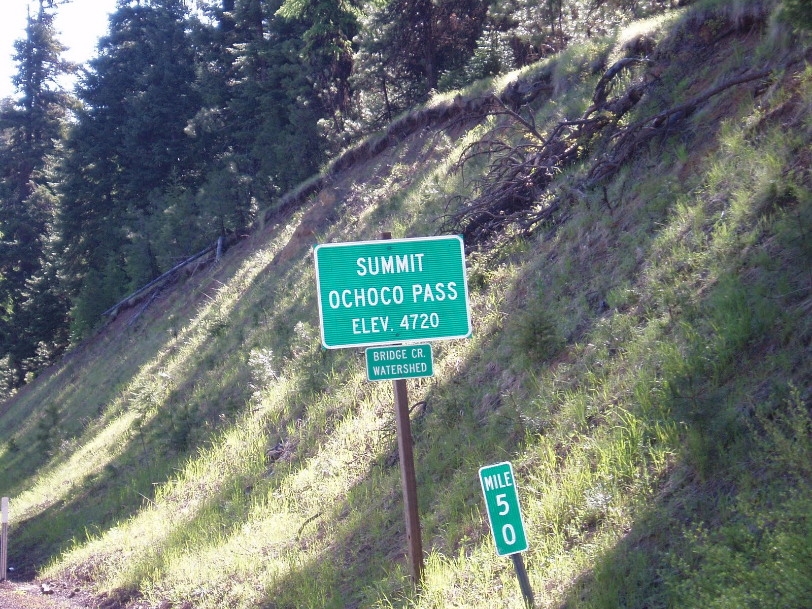
Ochoco Reservoir- nice campground on the west end, cheap rates for hiker and biker sites, but still didn't feel like the right stop.  East end of the reservoir:  Coolest thing I have seen so far- Pelicans!  I did not realize we had pelicans in Oregon, and here I find hundreds of them.  The good news, I have lots of pictures. Bad news, this computer does not recognize my camera, so I can't upload them yet.

That night was a brush camp along a stream in the Ochoco National Forest.  Beautiful site, deer came down to water in the morning, not another soul around.

Next morning it is up over the Ochoco divide, then down in to Mitchell, where I found Eli and Tyler, two just out of high school boys riding to Missoula, MT, and Diana, who had just finished the veterinarian program at OSU and was biking her way solo to Georgia to check out the job prospects there.  Happenstance alliances seem to be the way of bike touring culture, and we continued on together, and by lunchtime found another half dozens cyclists stopped as a shady wide spot for lunch.  Turned out to be Laurie and her group from the Santiam climb.  I had gone from solo cyclist to one of a peloton of ten, ranging from seventeen years old to 74.  Laurie and Mike had biked this route seven years earlier, and knew something the rest of us did not:  the Dayville church.

At some point, Dayville Presbyterian Church realized they were on the major east-west bicycle route for cross country riders, and decided they had found their ministry opportunity.  Posted by the church doors is a sign:  Doors are open.  Please do not lock them on your way out.  Inside, the rules are simple.  Clean up after yourself, no alcohol or tobacco on church grounds, and don't sleep on the pew pads.  Showers, laundry facilities and the kitchen are all there for our use.  Sign in on the guest book, put a donation in the box if you can.  It seems like most can, since most of the appliance had tags noting they were purchased with biker donations.

Ten cyclists can spread a lot of gear all over a small church, and once all our panniers had exploded throughout the sanctuary and fellowship hall, we proceeded to clear out a large share of the inventory at the mercantile.  Ten cyclist have eight ideas of how to eat on tour, so pretty much everyone was on their own.  My goals are carbs for energy and protein for muscle recovery.  I need to eat some veggies again sometime, but they are not my current priority.

Surprisingly, only nine of us snore.  I'm not sure if I felt self-righteous or put upon, but at least I didn't keep anyone awake.

Today our paths split in John Day.  The others continued east, I turn south from here.  It was nice to have some company, but I am ready to return to my solo travels.  John Day has some museums and historical/cultural sites I want to see, and I need to check on the water situation headed south, so I probably won't make a lot more miles today.  So far, I know I love traveling by bike.  The whole mindset changes.  Blasting down the freeway in your car, seventy miles is a one hour blur, nothing seen, nothing really accomplished.  On a bike loaded to travel, seventy miles is a good day, a day where you saw all seventy miles, and know their contours intimately.

I leave you with this:

It is by riding a bicycle that you learn the contours of a country best, since you have to sweat up the hills and coast down them.  Thus you remember them as they actually are, while in a motor car only a high hill impresses you, and you have no such accurate remembrance of country you have driven through as you gain by riding a bicycle.  ~Ernest Hemingway

Until the next computer!

Thursday, June 16, 2011

T minus eleven hours

Tomorrow morning is time to hit the road.  I ditched work a couple hours early today to finish up the last minute preparations, and tomorrow morning I start my two week bike trip.  My ever-supportive wife Shelley will drop me off in Estacada, OR on her way to work, and from there I head east on Hwy 224, eventually headed to Frenchglen, OR.  My proposed route will take me through the painted hills and the fossil beds, areas I have passed through before but have never really taken the time to SEE them.  When I hit John Day I will head south through and past Burns in to the high sagebrush desert of Oregon.

I love not only the raw beauty of this area, but the history as well.  Homesteaders, cattle barons, sheep stations, cavalry outposts and Indian wars.  Hart Mountain antelope refuge, bird sanctuaries, Kiger mustangs, the Borax Lake chub for the animal enthusiast.  Fans of flora are not to be disappointed either, with sagebrush, rabbit brush, Indian paintbrush, primrose, and thousand year old junipers.  The Frenchglen hotel, where Shelley and I have reservations for the final weekend of this journey, dates back the to lat 19th century, and is currently owned by the Oregon State Parks and Recreation Department.

Follow along on this blog.  As I get Internet access along the way, I will update with pictures and stories from the road.  I have a general route in mind, but overall I am keeping the plans pretty loose so I can just let the ride happen.

To be continued....

Tuesday, June 14, 2011

Bikes on the Mississippi

Avenue that is, not the river.  I did not get to take part in much of Pedalpalooza ( http://www.shift2bikes.org/cal/viewpp2011.php ) this year, but I did get to check out the goings on Sunday on Mississippi Avenue.  The street was blocked off for a sort of mini cyclovia prior to the start of the officially festivities, and closed streets usually mean parking nightmares.  Not so for this event: 


There was even room to spare:


Local author Joe "Metal Cowboy" Kurmaskie did duty as grand marshal for the art bike parade, followed by some most interesting examples of pedal powered art.


Bikes can be serious too, and the cargo bikes showed some serious ingenuity and capacity.  On a warm day, my favorite non-racing entry has to be this:


Yes, I said that was my favorite non-racing cargo bike.  Next up was the cargo bike race, in which the racers were required to stop at the ReBuilding center to pick up their load of recycled building supplies, mostly plumbing, and continue laden through the course.


The competition was fierce as the racers stood for the sprint, wringing every available bit of speed from their finely tuned machines.


The wrap up for the day was the critereum racing, an OBRA sanctioned event that brought out a number of the local fast guys (and gals) on the rain slicked course.  I've never watched a crit that did not include some carnage, and this was no exception.  I have not heard reports of any serious injuries, but there were crashes enough to thin the fields.  I hope that as this blog continues the quality of the photography will improve, but here are a couple attempts at action shots during the race.


All in all, an enjoyable overview of local cycling fun, with something for everyone, no matter your shape or size.


Taco Pedaler


Ahh, Portland, land of the bicycle, land of the food cart and the land of some really cool mash-ups.  Shelley and I were looking for lunch on Sunday when we stumbled upon the Taco Pedaler trikes.

These two trikes, one serving as the prep cart, the other as the hot food line, turn out some pretty incredible food.  We both opted for the special- one taco, one "dilla" (think English pasty meets Mexican food), chips and salsa.  Shelley chose the chicken for her taco, and I went for the pork.  The chicken was good, very good, but the pork was fantastic.  Probably the best Mexican inspired pork I have had locally, and there is plenty around to compare it to.  Vegetarians and vegans are not forgotten either, but I will have to visit again to give a first hand report on that fare.  Based on my experience thus far, I'm not dreading the task!

These are functional and mobile tricycles, so they move around.  Check out their website to see where they can be found, you will be happy you did.  http://tacopedalerpdx.com/

Friday, June 10, 2011

Day Tripping

Well, I am not getting this update posted as soon as I had hoped, but better late than never.

Saturday the 4th I decided to go for a longish ride.  Shelley (my long-suffering wife) had plans to spend the day with some of her friends, and we finally got some decent weather, so what better way to spend the day.

I had Shelley drop me at a starting point along the Springwater Corridor in Portland to begin the journey.  The Springwater is a Multi Use Path that runs from the Willamette river in southeast Portland eastward to the town of Boring.  It is fairly flat, and car free other than where it crosses roads.  It can get crowded on a nice day, and especially on a nice weekend day, but I hit it early enough to miss most of the crowds and was able use it to get out of Portland quickly and simply.

From Boring I continued east on highway 22 to hwy 26.  26 is a busier road than I usually like to ride on, but it generally has wide shoulders and good enough site lines that I felt safe among the traffic.  The first goal was to get to the town of Sandy for a refuel stop at Joe's Donuts.  Joe's is kind of a landmark, and you can get a little bit of real food in addition to donuts.  One breakfast burrito and an old-fashioned donut later I was on my way again, almond bearclaw safely tucked away in the handlebar bag for later.

Still on hwy 26, I was soon reminded of the best thing about traveling this route:

Mt. Hood, as viewed from hwy 26

It did not take long to remember the one drawback to riding towards the highest point in the state:  it is uphill from anywhere you start.  I also realized that I had heard the parts of the morning's weather forecast I wanted to hear, namely "sunny and highs approaching 80 degrees", and completely disregarded the part about "winds from the east".  Oops.  Made for a long slog up the hill, but I kept getting closer, and the view kept getting better:


My route coincided with one of the old wagon roads from the early settlement of the west, and one of the joys of traveling by bicycle is the ease with which you can stop at anything that looks interesting.  Indeed, any excuse to stop for a moment was welcome by this point.  This historical marker explained the challenges faced by early travelers on this route:

By this point I wasn't thinking that current day travel by bike was that easy either.  It was definitely getting time to find some lunch.  Government camp was not too far away, and is home to a pretty decent brewpub.  One of the many joys of bike travel is getting to eat enough to fuel the trip.  I could hear the beer and a burger calling my name.

Government Camp isn't much of a town, it basically survives due to the ski areas on Mt. Hood.  If you need food, beverage or ski equipment you are pretty well covered.  Much of anything else, forget it.  Still, history abounds here as well, enough so to merit their own wooden sign:


At this point I had covered 58 miles, and climbed about 3,800 feet.  After a sizable lunch I headed on, just a few more miles on hwy 26 until I turned off on to hwy 35 headed to Hood River.  The climbing part of the ride was almost done, or so I thought.

Hwy 35 has much less traffic than 26, but narrower shoulders and more gravel and debris along the edges.  Despite the refuel stop, the legs were protesting the climb and I was ready to head down hill.  As a cylcotourist, you learn to love the sign that promises "Right Lane Ends", as that usually means that the climb ends as well.  Even more promising is the summit sign:

The Summit was welcome news, and access to Barlow Road, another old wagon route, sounded interesting as well.  The pannier on the side held enough extra food, water and clothing to allow a bit of exploration, so on towards Barlow Road I went.

Not today.


That was a short lived detour. We have had an incredibly wet, cold spring and even though the main roads are snow free, this one has received no attention from the plows.  In retrospect, it is probably as well that I hit the snow right away, as it minimized the miles spent backtracking to the main highway.

Back to hwy 35, but at least I was at the summit.  Summit means top, right?  So it should be all downhill from here.  Emphasis must be placed on the SHOULD.  Yes, there was a nice bit of coasting after the summit sign, but it was followed all too soon by a climb up another spur on the east side of Mt. Hood.  Finally, the road did truly head down hill to the Hood River Valley, one of Oregon's major fruit producing regions.  The orchards I remembered from growing up nearby are still there, but a more recent addition to local agriculture is the vineyard.  Tempting as it was to avail myself of some of the tasting rooms at the wineries I passed, the time was getting late, and Shelley was expecting to meet me in the town of Hood River.

Mt. Hood was behind me, but that does not mean I was done with mountain views to draw me on along the road:
Mt. Adams from Hwy 35

The best thing about looking at Mt Adams was knowing that it is in Washington, on the other side of the Columbia river, and not on my route for today.  Another time with fresh legs perhaps, but that is a ride and a story for another day.

An uneventful ride on in to Hood River where Shelley was waiting for me to load the bike up on the car (sorry, no bike ride back home on this trip), and share a meal before heading home for a well deserved nights sleep.

Friday, June 3, 2011

Welcome to the VeloRedux blog!

Well, now I have my own little chunk of cyberspace so I too can share my views with the world.  While this blog is being started as a way to share pictures and stories from the road during an upcoming bicycle tour, I will keep it up as a way to share my thoughts, opinions and views, primarily on bicycles and cycling, but also on other topics as I feel the need.  The plan is to include plenty of pictures too.

Since the bike trip later this month is the motivator behind starting this blog, I will start with the basic plan behind the trip.  I love central and eastern Oregon, but it seems like I only get to pass through the Steens Mountain area.  Being blessed with a job that provides plenty of paid vacation and and understanding wife, I decided to take a couple of weeks to bicycle from my home near Molalla, OR to French Glen, traveling through the Painted Hills and the John Day fossil beds.  I am keeping the planning pretty loose, I have a route in mind, and more than enough time to get there so I can stop to smell the roses (or sagebrush and juniper more likely).

For the bike geeks, I am riding a Kona Sutra for this trip.  The Sutra is a steel framed, disk braked bike designed for loaded touring.  It is a bit on the heavy side, but stiff and stable under touring loads, and rugged enough for whatever may pass for a road on my travels.  Many touring riders shun disk brakes, but living in the Pacific NorthWet (yes, I meant to spell it that way) I can't imagine trying to tour with rim brakes.  Fenders are a must as well.  This bike is a fairly new purchase for me, so no major modifications so far.  I did replace the stock WTB saddle with my well-worn Brooks, and bolted on my pump of choice, the Topeak Road Morph.  A pair of Ortleib panniers for the front, sleeping bag and tent strapped to the back, and I am ready to roll.

One thing I should make clear:  None of the companies or brands I mention in this blog are (as of 6/3/2011) providing me with any compensation of any form.  Any opinions or product reviews are based on personal experience and observation, and will be as accurate and unbiased as I can make  them.  That said, if anyone in the bike industry wants to kick some sponsorship my way I will welcome it, but my opinions are still my own, and if your product doesn't work for me I will say so.

That is enough rambling for now.  I'll try to get some pictures for the next post, make this a little more interesting